English
 Español
 Français
 Deutsch
 Italiano
 Português
Colombia, as a nation-state project, reached the Amazon through militarization during and after the border conflict with Peru in the first half of the 20th century. This militaristic approach marked the course of the country's relations with the Amazon region to this day.
In 1912, at La Pedrera, on the Caquetá River, the first battle between the two nations' military forces took place. This was the prelude to a diplomatic conflict that would culminate in war and later determine the ratification of the Salomon-Lozano Treaty. In this treaty, Peru recognized Colombia's so-called Amazonian or Leticia Trapezium, a geometric trapezoid-shaped layout based on specific water crossing points on the Caquetá, Putumayo, and Amazon rivers. This border delimitation would guarantee Colombia access to the Amazon River. Colombia would also recognize Peru's sovereignty over the San Miguel-Sucumbíos Triangle, an enclave between the San Miguel and Putumayo rivers, in the foothills of the Napo-Putumayo interfluve.
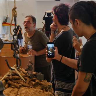
The delimitation of territory based on geometric abstractions was a symptom of the modernization project for the Amazon established by nations, which paid little attention to the ways and relationships of life of the native inhabitants and harshly divided the territory, optimizing the exercise of constructing an imagined border. Rivers that had once been meeting places now became arbitrary separations. Once the border conflict began, power centers implemented initiatives to populate and colonize the Amazon rainforest, where military incursions were followed by the construction of trails and evangelizing and civilizing missions. Thus, during the war, small population centers developed that provided services to the military garrisons.
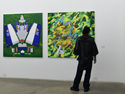
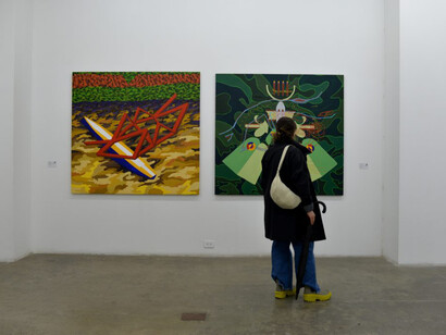
The modernization project was consolidated with the development of new warfare technologies, which allowed for a vertical understanding of the territory provided by flying over the jungle. In 1932, war broke out with the capture of the town of Leticia by a group of rubber barons based in Peru. This country had a fledgling military aviation fleet equipped with some Corsairs acquired from the US and manned by Peruvian pilots. Colombia, on the other hand, had to adapt commercial aircraft from SCADTA (Colombian-German Air Transport Society) for combat and landing on the Amazon rivers. These Junkers were manned by former Nazi German soldiers. Colombia was equipped with American Curtiss aircraft and, in turn, trained Peruvian pilots.
Geometric treatises is a study of geometry in the conflict. They are dissections of the main aircraft that were present in the war, disassembled to construct flattened bodies from shapes adapted from papercraft, composed on a series of maps used during the conflict, some of them created by Lieutenant Domingo Melo, a Peruvian officer. The maps here appear as an attempt to abstract the territory from the verticality allowed by the nascent military aviation of both countries. The planes are presented as evolved bodies, adapted to the conditions of the landscape, but also as elements that transform into the jungle canopy, like a textured background of military camouflage. The landscapes represented here were key points during the conflict and are places that have occupied the category of borders at some point in history. They are unstable borders that we could call "liquid borders," following Bauman's postulates. However, rivers, as liquid surfaces, have been places of encounter and cultural and biological exchange for both the inhabitants of the territory and the ecosystem itself.