English
 Español
 Français
 Deutsch
 Italiano
 Português
The power to name is the power to define. The names we give to places are more than just labels; they are narratives and discourses etched onto the landscape, reflecting histories, cultures, and power dynamics. As Nash1 (1999) argues, place names are "various expressions of identity, power, location, and culture," linking geography and language in complex ways.
The U.S. administration's decision to alter the name of the Gulf of Mexico to the Gulf of America is more than a simple name change; it is a symbolic act with far-reaching implications, as place names are never neutral. Regardless of whether this action is viewed as arrogance, an assertion of power, or simply provocation, this essay focuses on the power of naming, broader themes of power, identity, and the human relationship with the environment. This essay argues that the proposed renaming of the Gulf of Mexico reveals how place names are inextricably linked to power, identity, and the often-overlooked fluidity of maritime space. Specifically, it examines how the act of naming, the role of cartography in solidifying names, and the inherent fluidity of the sea intersect to reveal the complex ways in which power is exercised and contested through the control of space.
The power of naming
While the controversy surrounding the proposed renaming of the Gulf of Mexico highlights the political implications of toponymy, it also serves as a point of entry for examining the broader, more nuanced ways in which naming itself wields power.
Names of seas, rivers, mountains, and other geographical features stem from complex historical, political, and cultural processes. Place names are integral to the process by which people attach meaning to place, and as signifiers of place, place names evoke powerful emotions. Therefore place names are not mere labels; they are imbued with cultural, historical, and political significance, shaping our understanding of the world and reinforcing power dynamics. Additionally, names are part of a symbolic and material order that provides normality and legitimacy to those who dominate the politics of place representation. Thus, the naming of places is a key component in the relationship between place and the politics of identity in societies. Understanding the complex layers of meaning embedded in place names is crucial for analyzing the implications of renaming efforts.
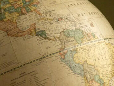
The role of cartography
The power of naming truly takes hold when names are inscribed on maps, shaping our perceptions of space and reinforcing existing power structures. Maps are an important form of spatial construction, deriving their power from what could be called a hegemonic myth of mimesis – the widely accepted but ultimately flawed idea that maps unproblematically re-present places in their entirety. The apparent neutrality of the map is in direct opposition to its geopolitical function, as it serves not only as the most effective visual representation of physical space through its labeling and categorization but also as a tool for the appropriation and definition of space.
This inherent power of cartography to define and control space was particularly evident in its foundational role in the colonial project. As Gil and Duarte contend, cartography served as "a process of discerning and appropriating, of study and domination"2. Indeed, toponymy and cartography were central to nineteenth-century European empire-building, as Western nations consolidated their authority and eased their governance through the mapping of places, the compilation of lists, and the taking of censuses. Maps were thus used to assert authority and claim indigenous territory.
Consequently, cartography can be regarded as a form of symbolic violence, effectively defining, delimiting, and rejecting alternative interpretations and claims to space. It imposes a particular worldview, often at the expense of marginalized communities. Place names play a fundamental role in mapping, for they provide the means of filling “empty” space (on maps) with points of interest. The choice of place names on maps, therefore, is not a neutral act; it communicates an ideological meaning about the place, reinforcing particular narratives and power structures.
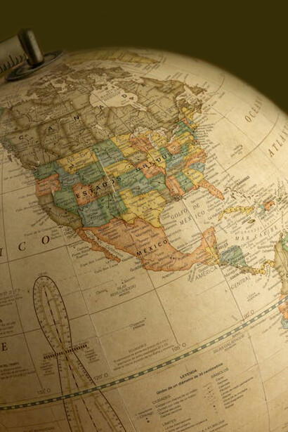
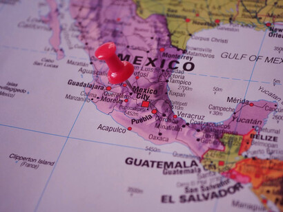
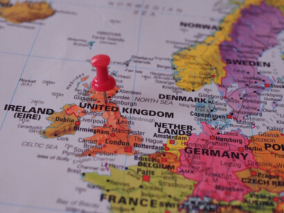
Renaming the Gulf of Mexico
The principles of cartographic power discussed above are exemplified by the proposed renaming of the Gulf of Mexico, which reveals the complex interplay between naming, mapping, and geopolitical influence. Naming places reinforces claims of national ownership, state power, and control. Therefore, whoever has the power to name a place exerts ideological control over it, in some way claiming ownership or influence. In the case of the Gulf of Mexico, the U.S. decision to change its name can be seen as an attempt to assert U.S. hegemony over a geographically strategic area. The renaming of the Gulf of Mexico is an example of how toponymy can be used as a tool of political and cultural power.
Places are not simple labels; they carry profound meanings and affective ties. Changing the name of a place means intervening in a shared symbolic and cultural heritage, denying the right of local communities to recognize themselves in a territory they consider their own. By renaming the Gulf, the U.S. isn't just changing a label; it's attempting to redefine the very space itself, to bring it under its symbolic control, and ultimately, to make that control visible and tangible on the map. Thus, toponymy inherently reflects a knowledge/power relationship, where the choice of a name conveys knowledge about a place and reinforces existing power structures.
The fluidity of maritime space
Combining the previous points about naming with this cartographic perspective, we can see how the renaming of the Gulf of Mexico isn't just a symbolic act, but also a potential cartographic one. If the US were successful in widely disseminating the new name "Gulf of America," it would eventually appear on maps, thus physically inscribing that act of appropriation onto the very representation of the space. This act of cartographic inscription reinforces the power dynamic, mirroring the historical use of maps as instruments of colonial domination.
But the very act of renaming, with its implications of fixed boundaries and territorial ownership, ignores the fundamental characteristic of the sea: its constant movement and interconnectedness.
The practice of mapping is not merely a tool for understanding and shaping space, but also a means of knowing the non-mapped, the unseen, and the uncharted. On a conventional world map, the sea appears in a predictable manner: blue, flat, and seemingly unchanging, as if it were an immutable entity in both space and time. The cartographic representation of the sea aligns with the conventional approach employed in representations of land, utilizing lines that delineate latitude and longitude.
These lines are distinguished by variables, with the most salient distinction being the demarcation between landmasses that are inundated and those that remain above water3. Adopting this cartographic representation, the planet is perceived as a dichotomy of two distinct spaces: the static terrestrial realm, capable of being settled and organized into states, and the maritime domain, devoid of qualities conducive to settlement and thus conceptualized as beyond the scope of society. However, this cartographic representation falls short of capturing the complexity of the aqueous entity as a mobile space whose essence is defined by its fluidity.
While the Gulf of Mexico itself could be delineated on the map, the political and social realities of the space—the complex interactions of nations, the flow of people, and the struggles over resources—are often obscured or ignored. The renaming attempt, in a way, tries to erase these complexities, presenting a simplified, and ultimately biased, view of the Gulf as a space primarily defined by its relationship to the US. It creates a kind of cartographic blank spot where the histories and experiences of other nations, and the very fluidity and interconnectedness of the maritime space, are rendered invisible.
This "blue, flat, and changeless" image obscures the sea's dynamism, its role as a connector, and the complex human activities that take place within it. The sea remains shifty, cannot help changing, and so it is neither a fixed entity nor a completed project. It is a “vibrant matter”4, characterized by its constant movement, its interconnectedness, and the vitality of entangled human and non-human elements. It is a space of constant becoming. By focusing solely on the land-sea divide, traditional cartography fails to capture the intricate reality of the marine environment and its significance for those who live and depend on it. The renaming of the Gulf, within this context, further contributes to this simplification, reducing the Gulf to a mere geographical feature within a US-centric worldview that disregards the perspectives and experiences of other nations and communities that interact with and depend on this vital space.
Conclusion
In conclusion, the attempt to rename the Gulf of Mexico is far more than a simple matter of nomenclature. As this essay has demonstrated, it represents a multifaceted exercise of power, intertwining the symbolic realm of naming with the concrete reality of cartography. The proposed renaming seeks not only to label but also to redefine and control a space, echoing historical patterns of colonial appropriation and reinforcing a US-centric worldview.
By examining the interplay between the act of naming, the role of cartography, and the inherent fluidity of maritime space, we have seen how power operates through the control of space, shaping our understanding of the world and influencing our relationship with the environment. The case of the Gulf of Mexico highlights the urgent need to move beyond simplified cartographic representations and recognize the complex social, political, and ecological realities of maritime spaces. Ultimately, this analysis underscores the importance of critically examining the power dynamics embedded in the names we give to places and the maps we use to represent them, recognizing that these seemingly neutral tools can have profound consequences for how we understand and interact with the world around us.
References
1 Nash, Catherine (1999). “Irish placenames: Post-colonial locations”, Transactions of the Institute of British Geographers, vol. 24, no. 4, pp. 457–480.
2 Gil, Isabel Capeloa and João Ferreira, Duarte (2011). “Introduction: modernity's fluid cartographies”, Journal of Romance Studies, vol. 11, no. 1, pp. 1-9.
3 Steinberg, Philip E. (2013). “Of other seas: metaphors and materialities in maritime regions”.
4 Bennett, Jane (2009). Vibrant matter: A political ecology of things. Durham: Duke University Press.