English
 Español
 Français
 Deutsch
 Italiano
 Português
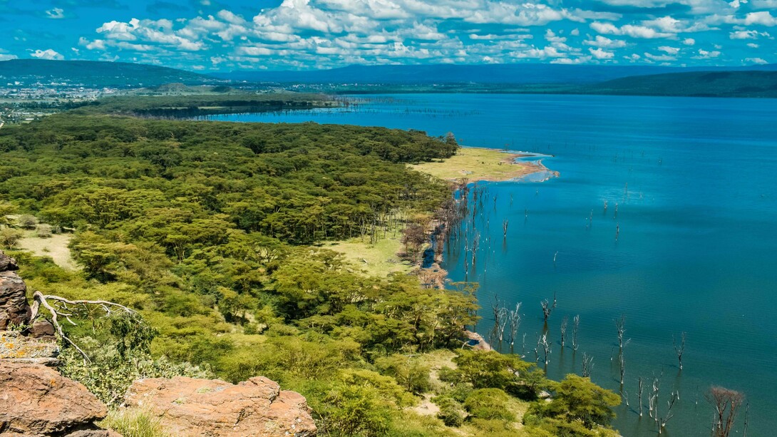
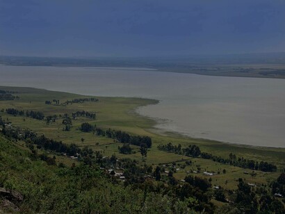
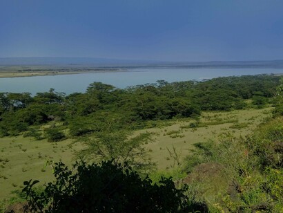
Water level rising, in particular, sea-level rise is one of the key impacts of climate change. These rises have and continue to pose existential threats to affected communities, countries, and regions. Tuvalu, whose highest points reach 4.5 meters above sea level, is a good example of this. During the COP 23, it was one of the current forecasts due to the threat of sinking that rising tides and more frequent and intense rainfall events pose1. In Kenya however, there has been a different kind of water level rising not along the Kenyan coast but inland in areas as high as 1883m with the lowest being 361m above sea level. The phenomenon: lake level rising.
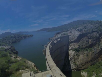
Since September 2010 to date, there has been a trend in the Rift Valley's lakes, the Turkwel Dam, and Lake Victoria of water levels rising, that have caused great havoc in their wake. These lakes have experienced an exponential increase in surface area with the highest being Lake Ol'Bolossat at 186.59 percent. A scoping report by the Government of Kenya and UNDP2 in 2021 found that the rise in lakes level has resulted in the submergence of about 110, 600 Ha (1,106 km2) of land within and adjacent to the lake, the displacement of 75,987 households and biodiversity loss resulting from loss of riparian vegetation.
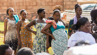
The report highlighted climate change as the main reason for this phenomenon. This is due to increased precipitation resulting in increased discharge of the rivers feeding the lakes. Underground water saturation is another culprit for this phenomenon. Most lakes have no surface outlets. The groundwater saturation limits the out-flow hence affecting the lake’s discharge. Land-use changes have also contributed, resulting in siltation of the lakes due to increased soil runoff. The movement of tectonic plates in the earth’s crust has also been considered as well as the restoration of catchment areas by the government, but the residents of these areas, such as in Lake Turkana, believe the water is coming back home. A documentary aired in January 2021 by a local TV station NTV gave a voice to the local communities of these areas, some of whom have been forced to move four times since 2010. Understanding these impacts on the communities, the lake regions, and the country, in general, requires an understanding of what the lakes mean to the country and its people.
When I was in primary school, in what was then referred to as class six, in my late 11th year of existence, we had a very passionate and committed Geography teacher, who also happened to be our class teacher. Her name, Mrs. Reriani. She was feared and respected in equal measures, and at that time was in what I imagine was her 50s. How I ended up sitting next to the teacher's desk is another long story. But let’s just say it was the worst sitting place. Why? When the teacher walked in, you were the first pupil they saw and for Mrs. Reriani, the first target of her questions. She used to suddenly walk in, almost always head straight to that desk and ask "Name one of the lakes along the Rift Valley?" Let's just say I had to learn them by heart after always suffering the dreaded consequences of not having a single clue of a topic she had taught and referred to severally. I bet she would be proud to read this.
The Rift Valley is a valley of wonders. Dating back to 22-25 million years ago, it is a long depression with steep sides called escarpments that were formed because of faulting. The rifting started in the Red Sea and spreads to Djibouti, Ethiopia, Kenya, Tanzania, Malawi, and Mozambique, creating the East Africa Rift System. This system is characterized by a sequence of related basins and is the home to the East African Great Lakes. These fault lines and escarpments control run-off and flow into the rift valley. They also influence rainfall pattern and intensity, with major escarpments experiencing intensified rainfall2.
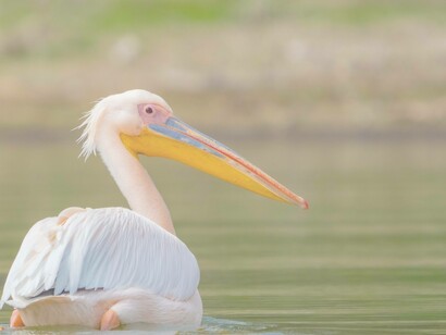
In Kenya, these lakes include Lake Nakuru, whose park boasted having among the highest biodiversity in the country. These included over 450 bird, 50 animal and 300 plant species, and are renowned for lesser flamingos. Lake Elmenteita is a Ramsar site and famous for greater flamingos. Lake Bogoria, is known for its hot springs, geysers, and also flamingos. Lake Naivasha and Baringo, are both freshwater lakes and a key source of income for the local population. Lake Magadi famous for trona extraction. There is also a diverse range of wildlife present in and around the lakes including zebras, gazelles, warthogs, hippopotamus, waterbucks, impalas, and numerous bird species. Given this magnificent topography and experience, the lakes provide great tourist attraction sites. Tourism accounts for about 8.8 percent of the country’s GDP. These in addition to food sources from the lakes, make them a key source of livelihood for the communities.
Hence, these lake levels raising have completely devastated the communities living around them. The submergence of the land has led to the loss of life and property. It has resulted in the lack of access to clean and safe drinking water due to the destruction of boreholes and contamination of surface and groundwater resulting from the submergence of sanitation facilities. This has increased the risks of contracting water-borne diseases. Worst still, health facilities that could mediate this have also been submerged. Cultural and touristic attraction sites have not been spared. For example, in Lake Bogoria most of the hot springs and geysers have been submerged with a drastic reduction in the number of flamingoes given the destruction of their feeding areas.
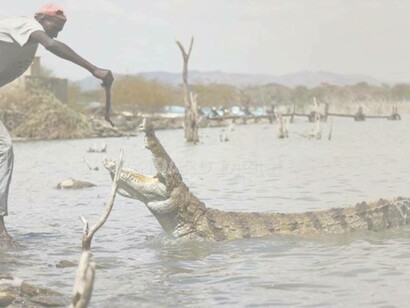
The scoping report paints a picture of how economic activities in the areas have been immensely affected. Fishing activities have been altered due to infrastructure and breeding sites damage. Hotels, campsites, and local businesses around them have become part of the lake. Farmlands, as is the case at Lake Solai, have been submerged leading to the loss of crops while in other areas irrigation schemes are a distant memory. For livestock farmers who salvaged their livestock, they are faced with the challenge of lack of pasture and loss of grazing land which is resulting in conflicts within pastoral communities over grazing land. They are not the only ones. Wildlife has also moved to higher grounds in search of food, with the increased proximity of the lakes to settlement areas bringing about human-wildlife conflict. In the documentary, a crocodile was seen basking on what was once the roof of someone's house.
Accessibility has been impaired with roads cut off or submerged, and electricity supply interrupted due to infrastructural damage. All these and not forgetting the trauma and psychological problems associated with these impacts of displacement, insecurity, and losses. The unfortunate part, this is not a nightmare we can wake up from. The story for Lake Magadi is different though. An estimated 30 percent of the lake is now silt while Lake Kamnarok which was at some point the most populated with crocodiles second to Lake Chad is dying off due to siltation. This has been in part because of rail and road infrastructural development that have created deep gullies and due to sand mining, increasing the flow of slit in the rive feeding the lakes.
Regardless of the cause, the impact is the same. This phenomenon of lake rising provides a clear picture and a snippet of the catastrophic impacts of water levels raising both sea and lake. A key takeaway in my opinion is that you cannot talk of climate action without sustainable development. Although the global sustainable development goals are listed as 17, I see them as one goal subdivided into sections. The causes and impacts of the lake level rising provide a clear picture of this. There is a need for sustainable and climate-resilient development characterized by proper governance, community participation, improved data collection, and observation to facilitate modeling and prediction.
Governance to avoid issues like the lack of compensation for communities settled on riparian land as it is public property. It is also instrumental in garnering and building communal resilience. Data and modeling as also recommended by the scoping reports, to determine the highest water levels to redefine the riparian land and create buffer zones. Although these measures might prove costly in the short run, for instance as compensation for legally owned land that will be demarcated as riparian land or investing in climate-smart infrastructure, the potential future losses provide a case for this.
The waters cannot be stopped from rising or the current situation undone, what can happen is being proactive to avoid a repeat of this in the future. The Netherlands is leading in this, showing how we can live with water. The turning point of the 1953 floods leads to the embarking on flood prevention initiatives such as the delta works and programs that create fortresses while working with nature and the community. If only one could copy and choose the paste option that matches the country’s needs, but oh well!
Notes
Cop 23 Fiji (2017). Tuval.
Government of Kenya & UNDP (2021). 'Rising Water Levels in Kenya’s Rift Valley Lakes, Turkwel Gorge Dam and Lake Victoria'. A scoping report.
Joint Nature Conservation Committee (2022). Ramsar Convention.