English
 Español
 Français
 Deutsch
 Italiano
 Português
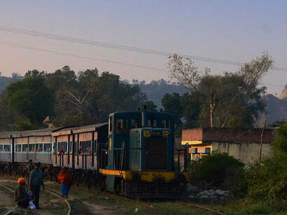
Nangal town is about 100 kilometers from Chandigarh and I was visiting my uncle’s house a gap of 3 years. I took an early morning direct flight from Bangalore to Chandigarh and from there took a cab to reach Nangal by end of the day while stopping over a couple of places while on the way few of which were historical ones. The connecting road is very good, barring a very small stretch where there is no divider on the road. The 2nd day of the trip started very early as we had to leave for Sri Naina Devi temple and had to reach back Delhi by end of the day. It was going to be a very long day and hence we had decided to start very early. This would have also helped us in avoiding the rush of devotees at the temple.
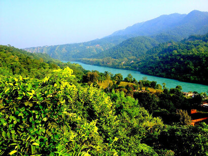
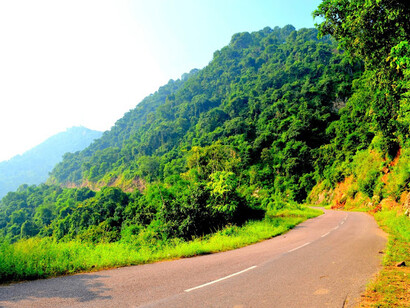
Whenever I visit Punjab, a trip to Sri Naina Devi temple is always on the itinerary. Though the road from Anandpur Sahib provides the shortest and quicker route, I always prefer to take the Bhakra Road or what I call as Sutlej Coast Road. The distance from Nangal to Sri Naina Devi Temple is about 28 kms and the road runs parallel along the Sutlej River bank and we cross majestic Bhakra Dam on the way.
The Sutlej River is the longest of the five rivers that flow through the Punjab in northern India and Pakistan. It is located on the south of the Hindu Kush segment of the Himalayas and on east of the Central Sulaiman Range in Pakistan. It is the easternmost tributary of the Indus River which has many tributaries.
It originates at Lake Rakshastal in Tibet and covers a course of about 1500 kms before it merges with Indus which eventually merges in Arabia Sea near Karachi. The waters of the Sutlej are allocated to India under the Indus Waters Treaty between India and Pakistan, and are mostly diverted to irrigation canals in India. There are several major hydroelectric projects on the Sutlej, including the Bhakra Dam and the Nathpa Jhakri Dam.
Bhakra dam is located at a gorge near the (now submerged) Bhakra village in Bilaspur district of Himachal Pradesh has a height of 226 m. Before Tehri Dam (265 meters) was opened in 2006, Bhakra Dam was the tallest dam in India. The length of the dam is 518.25 meters and the width is 9.1 meters. Its reservoir, which is named "Gobind Sagar", stores up to 9.34 billion cubic meters of water. The 90 km long reservoir created by the Bhakra Dam is spread over an area of 168.35 kms. In terms of quantity of water, it is the third largest reservoir in India, the first being Indira Sagar Dam in Madhya Pradesh and second Nagarjunasagar Dam in Andhra Pradesh. The dam was completed in 1963.
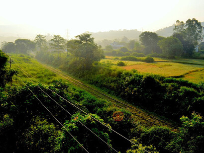
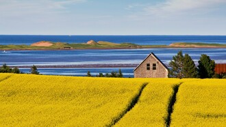
The whole road is fully of scenic beauty. When we started from Nangal, the initial stretch was in semi-plains but full of greenery on both the sides. At many places it seemed as if we are driving into bushes which sometimes gave a feeling of entering into a tunnel. After a while, we started the climb as hills started and road became curvaceous. There were many points where you would want to stop and spend some time to absorb the surrounding beauty. We also stopped over at some places and one such place had a beautiful view of the Sutlej river and the Bhakra dam.
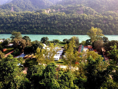
In about an hour after stopping over couple of times on the way we reached at the top of the Dam. A statute of India’s 1st Prime Minister Mr. Jawaharlal Lal Nehru welcomed us. There is a park overlooking the dam opposite statute. One can spend some time to have the top down view. Few meters ahead, there is a podium whereby one can have the view of the Gobind Sagar. This is an old building and I guess this is an old Boat Station whereby people would take boats to cross over the lake. We spent some time there and it was an interesting sight as the Lake was full of water till the top of the dam. In my earlier visits, I had always seen the water much below the current level.
We started with our last leg. Though it does not take more than 45-60 minutes to cover the distance till Naina Devi, it took us about 2 hours as we had stopped at many places. Apart from river and the dam, one interesting thing you would observe is the islets popping out in the Gobind Sagar. I am sure these islets will remind one of Scottish islets with private villas though I am not aware if any builder has started developing villas on these islets.
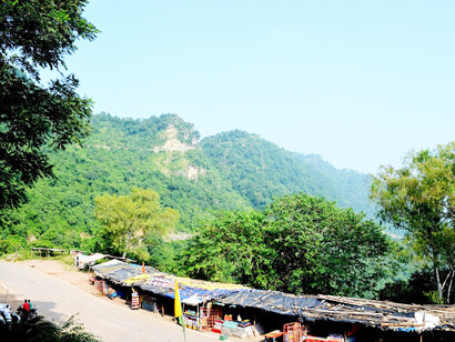
Road at some places is not in very good condition due to heavy rains which wash away the roads. If these roads could be made of good and strong material, this stretch could become tourists delight. I would recommend to the tourism authorities if they can develop and promote this segment as Sutlej circuit by developing some basic facilities on the way, it will see lots of tourists visiting. I will write about that in my next article.
Finally we reached the spot from where we can take rope-way to reach the Naina Devi temple. I must add that the whole stretch is shutter bugs delight.