English
 Español
 Français
 Deutsch
 Italiano
 Português
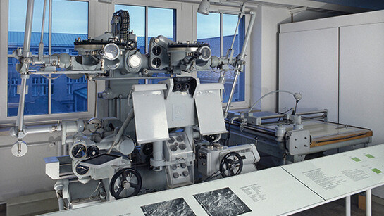
Nowadays we need only glance at a navigation device to know with great precision where we are on Earth and to be guided reliably to our destination. Satellite technology is a necessary condition for that, but not a sufficient one. A further important prerequisite is a comprehensive survey of the surface of the Earth, representing it in the form of maps.
The subject concerned with those tasks is known as geodesy. It is a very old scientific and technical discipline, closely linked to astronomy and mathematics. Surveying was long regarded as ‘practical mathematics’, and many of the instruments used were considered to be geometrical instruments.
From the start, geodesy was an applied discipline. For example, attempts to determine the precise shape of the Earth were extremely important for finding the best shipping routes. Maps based on measurements were an indispensable aid for such operations and therefore valuable. Defining boundaries between countries and properties is still a central task of geodesy. Major projects – roads, railways, canals, large bridges or tunnels – would not be possible without precise surveys.
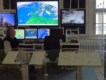
Important changes in the discipline came about in the 20th century with the possibility of exploring the Earth from a distance: at first with aerial photos, later by means of satellites. The development of the computer has also significantly influenced geodesy. Owing to the large quantities of data collected from various places on Earth, the term ‘geographical information system’ (GIS) is frequently used these days. Using computers, position-related data is collected, processed, stored, reorganized and presented for particular uses or purposes.
The exhibition is divided into two basic sections. The first section presents fundamental measurement methods and instruments, starting with explanations of how distances, angles and heights are determined. This is followed by an introduction to photogrammetry (i.e. surveying by means of photos), including aerial photogrammetry, before briefly touching on the use of GPS technology to determine location.
Engineering surveying: surveys carried out for the construction of buildings and other structures Finally, there is a brief introduction to the basic principles of cartography, answering the question of how maps are produced.
Apian’s new form of representation replaced the usual descriptive itineraries. Those were oriented on useful information for a journey, such as the state of the roads and where one could spend the night or change horses; instead of distances, they generally emphasized the time needed to cover a section of the journey. Apian, on the other hand, introduced the concept of ‘geographical space’.
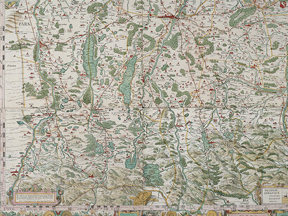
The exhibition begins with a juxtaposition of two Bavarian maps: on the one hand, that of Philipp Apian (1531–1589) from the year 1568, on the other, a modern representation of present-day Bavaria. The former marks the start of a new form of surveying in early modern days: geographical space measured and presented in the shape of a map. Apian’s map long remained the best available overall representation of Bavaria. It was not until the re-formed state of Bavaria was comprehensively surveyed in the early 19th century, based on military requirements and in connection with political developments in Europe, that a significantly improved set of maps came about. The demands were now for ‘precise’ and ‘scientific’ surveys.
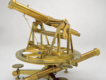
The theodolite, for measuring horizontal and vertical angles, can be regarded as the standard instrument of geodesy from the late 18th century onward. However, its use required an understanding of mathematics that many surveyors lacked. Often they still used a plane table, on which the map was laid out in the field by drawing in the lines of sight. Theodolite measurements, in contrast, were evidence of scientific precision.
We show a few instruments from the museum’s extensive collection, as examples illustrating the main tasks: determining distances, angles, and heights in the field. The development of the measuring instruments is sketched out, and at the same time the fundamental techniques explained.
A comprehensive analysis of aerial photographs requires a considerable technical effort, since overlapping pairs of photos have to be aligned precisely with one another.
Surveying by means of photos is a very important part of geodesy and is treated separately here. Photogrammetric images can be taken from a point on the ground (terrestrial photogrammetry) or from the air (aerial photogrammetry). Terrestrial photogrammetry is especially useful for engineering projects and in the mountains. Aerial photos are an important basis for surveys that find many uses. Following on from that, the exhibition touches briefly on satellite geodesy.
As explained here, one of the central aims of geodesy is to determine the precise figure of the Earth. That includes measurements of the local gravitational field (gravimetry). The basis of all further surveying operations is setting up a control network of selected fixed points on the ground, precisely surveyed and marked. There follows topography: the description of the shape of the ground, bodies of water, human habitation, transport routes and other surface features; also cadastral surveys for the official land registry. A large model of the 8-km (5-mile) tunnel under the Store Bælt (Great Belt) between two Danish islands shows the significance of modern engineering surveys.
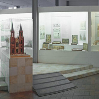
Surveying leads to maps. Maps from antiquity and the Middle Ages, and a series of globes from the 15th to 17th centuries, illustrate the relationship between the real world and its representations. When producing a map there are always decisions to be made on the type of representation: what is to be shown and how can that be implemented by means of suitable graphical techniques? We also show how a map is printed.

![Various artists, [ materialistin ], exhibition view. Courtesy of Hamburger Bahnhof](/attachments/fd8f4fd76b73be0a02d398535c29d017e1309b65/store/fill/330/330/3f54331fd7869a13166dfe67a9e91306c6e180b2e29b9fd308d958b87ad2/Various-artists-materialistin-exhibition-view-Courtesy-of-Hamburger-Bahnhof.jpg)